RouteYou network
What is the RouteYou Network?
The RouteYou Network is a set of paths and roads exclusively selected (using our RouteYou Method) for the purpose of recreational navigation by bicycle, motorbike or on foot. You can see it as a suitability network for a specific recreational activity.
This means that we have different networks for different modi (ie. cyclist, MTBer, hiker, biker,...). We show some examples of these networks in the RouteYou-Planner and in several GPS products we create for partners.
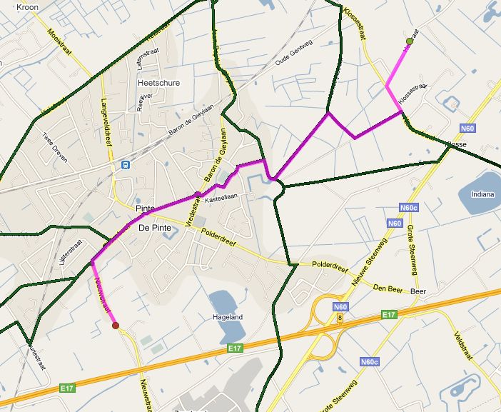
Example of the RouteYou cycling network
The RouteYou Network suitability
Although the network is binary (you belong to it or not), reality is much more subtle. Not every path of the RouteYou network is equal. It's correct that some elements are much nicer to cycle than others.
We indicate this in our network with a resistance factor (the lower the resistance of a path, the more suitable, and the more likely that your route will be calculated via this path)).
You could see the resistance factor as the inverse of the suitability factor.
We also create Hierarchical Networks of our Base RouteYou Network. You can see them as a selection (or subset) of the best elements of the Base RouteYou Network. But it is still a closed network!
Where do you find the RouteYou Network?
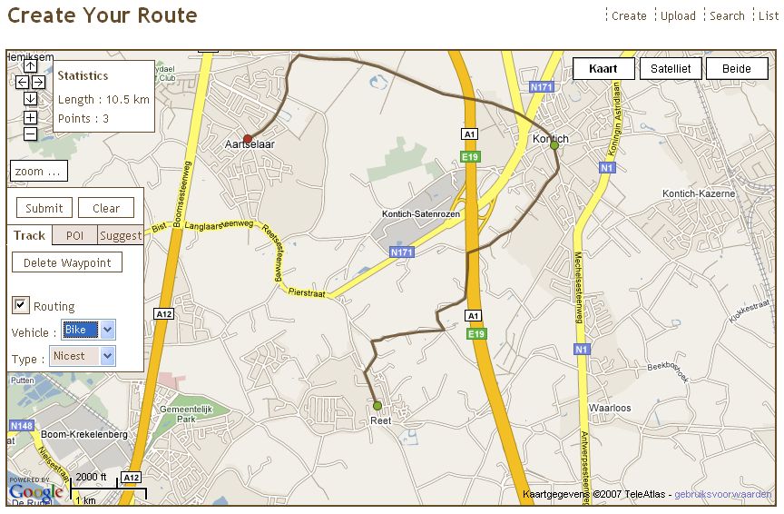 We make use of the RouteYou network in the RouteYou RoutePlanner
- You find the RouteYou Network in the RoutePlanner of RouteYou. You find it 'behind' the GoogleMaps. It is being used to calcualte a route. Read more about the Routing options and how they work in the RoutePlanner.
- We also 'offer' these networks on some GPS products, so you can also route over the networks on your GPS. (Check out this example of the netwerk on a Garmin Product).
If you are interested in the use of this network for your application, please contact sales[at-r.].
What does the RouteYou network contain?
The network contains two main items
- Geometry of paths and roads
- An indication (value) for each piece of the network about its suitability for using it as a hiker, cyclist, recreative motorbiker,...
Geometery of paths and roads
How does RouteYou get the extra geometry for recreational navigation
RouteYou targets to get as much of the public "slow roads" and recreational roads as possible. It is a continuous and never ending process.
We start from a reference road network of our partner(s) and extend that. In many cases, that network doesn't contain the most interesting paths for recreational purposes, or it is not clear which part of that network is suitable for recreational navigation.
We use several sources and our RouteYou community to extend this information.
[h4]A network based on a large set of professional routes[/h4] A large set of professional routes is provided by professional authors and partners we work with. We check if we can match these routes with the geometry we have. If we don't have the geometry we add it to our network based on aerial photography, topographic maps and other high quality reference data.
[h4]Specific networks of professional organisations[/h4]
We work with professional organisations providing qualitative networks for recreative activities such as e.g. cycling networks.
We check if we can match the geometry of the network with the network we have already. If the geometry is missing in our network, we are adding and integrating it in our network.
Some nice examples of these type of professional organisations are
- Fietsrouteplanner Toerisme Oost-Vlaanderen: Try it our here!
- Wandelrouteplanner Twente: Try it our here!
- Fietsrouteplanner Salland: Try it our here!
- Fietsrouteplanner Vechtdal:Try it our here!
- ...
These specific networks are of course the property of the customer. In some cases, we have an agreement with our customer and are allowed to sublicence that network to you. If you like to have more information, please contact sales[at-r.].
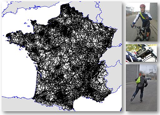
[h4]The community routes[/h4] The > 6 000 000 visitors so far on RouteYou have been quite active too. They made or uploaded more than 350 000 tracks.
Some added extra geometry (read more about it here).
We just don't take over any new track, but if there are several, it's worthwhile to check, and if correct, integrate it. This allows a guided way of updating.
This way, the community helps to improve the network, of which the results are provided back to the community via the (free) routeplanner. .
They also report problems via our MapReporter.
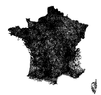
Example of the community input in France (plot of all the tracks of users creating routes)
Does RouteYou have all the roads and paths?
No. But we are getting close... You can deduce from the method above that we continuously improve and extend that recreational network. To get statistics, please contact sales[at-r.].
The suitability of each road and path for specific routing
Read more about how we calculate the suitability or nicesness of a road/path here.
Frequently asked questions
Is the RouteYou Cycling Network the same as the knooppuntennetwerk in the Benelux?
No. But there is an overlap since both networks have similar (but not the same) goals but another method to achieve it and as such another result. .
Here are a few major differences
- The RouteYou netwerk has a higher density
- Each element in the RouteYou netwerk has a suitability score and resistance value to indicate how nice or suitable an element of the network is. It is not binary. This allows us to provide better recreative routing solutions over longer distances.
- It is not limited to the Benelux and seamlessly integrated with the neighbouring countries
- It has NO system of indicators in the field to follow the netwok of RouteYou. This is the case with the official "Knooppuntennetwerken".