Nicest route
What is the "nicest" route or track

Everybody will agree that there is a nice way to go from A to B and that the nice way is not necessarily the same as the shortest or the fastest way.
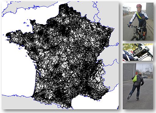
Obviously, the nicest will depend on your "modus". Simply said, it depends if you are on a bicycle, on foot or on a motorbike. As such, this is an example of a suitability classification.
Few will agree on what that nicest route is. After all, there is a saying in French "Des goûts et des couleurs, on ne discute pas" or that you don't discuss about taste. But talking about "nicest" routes is definitely about taste.
So we had to find a solution for it. And if you don't agree, you can still adapt and tune the route to your liking. And provide feed-back to the system.
How do we calculate the "nicest" route or track
From shortest path to nicest path
There are plenty ot techniques to calculate the shortest path (known as the "shortest path algorithms"). So we adapted those to calculate the "nicest path". Here is a glimps of how we do that.
We "devide" the lenght of each road, path or track by its NICENESS-FACTOR or SUITABILITY FACTOR(N).
So a track of 1 km with a NICENESS-FACTOR of 10 is 5 times "shorter" than a track of 1 km with a NICENESS-FACTOR of 2. So now you can apply the old "shortest path algorithms". But... here comes the hard work.
The only problem to solve is to calculate the NICENESS-FACTOR
Getting to the NICENESS-FACTOR or SUITABILITY-FACTOR
To calculate the factor NICENESS-FACTOR or SUITABILITY-FACTOR based on 3 main type of sources:
- Path and environment characteristics
- Professional references
- Community input
1.Path & environment characteristics

We take into account the characteristics of the path itself, based on parameters such as:
- is it a busy road/path
- is it allowed to use the road/path (by car, by bike,...)
- is the path paved, unpaved, and if so, is it in good or bad condition
- is the road intersected by many other roads
- how is the curvature of the road
- ...
Besides the the characteristics of the path itself, we also look into its environment:
- are you next, into or near a forest (+)
- are you next or near a lake, a river,...(+)
- are you next or in a natural area, national park, ...(+)
- are you going through an industrial area,...(-)
- ...
There are about 40 variables we use, and it is growing continuously. So you get positive and negative stimulae. Some working stronger than others... And of course, it depends on the modus.
2. Professional references

A second type of sources we take into account are sources that indicating that this path is part of route created by a professional author, or part of a network created by professional organisations.
3. Community input

"Routing engines that manage to incorporate behavioural data suggest routes that better reflect where cyclist really want to go. Routes suggested by such engines feel like they were suggested by a knowledgeable local human cycling expert, rather than calculated by a computer."
(Michal Jacob, 2017, Smarter Cycling Series, ECF)
The community of RouteYou creates and adapts routes they create. This is also a great source for verifying and adapting the formulae. A lot of people are not only planning the routes, but they are also collecting the routes via GPS, smartphones,... And they upload these routes to RouteYou.
A balance between nice and detours
There is a limit to how big you want to make your detour to follow the nices path. Also that balance had to be found...
Extending the network
A lot of recreative routes are following the existing road network provided by routing database companies. But a lot of the nice paths are missing.
RouteYou is using many other sources to build and extend that network. Read more about it here.
Something extra
And just when you think that "beauty" of roads or tracks is something that is hard to put in theory, Denis Dutton comes with a Darwinian theory of beauty. Check out his talk on TED.COM.