Clustering
Clustering on a map
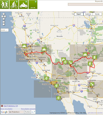
The map-clustering groups together a set of features (most of the time routes) on a map and shows only one symbol or square for the whole set.
There are two main reasons why we do this:
- Otherwiste your map view gets cluttered/overloaded
- If we would send all the data available, your browser would flip or it would take a very long time before you get all the results in
Here is an example where we use it on the Route Search:

In this case, the area of the map shows a large number of routes, but only a few are shown on the map and on the list.
You can see more in the following way
- Click on the (+)-symbol at the top of the list (repeat)
- Zoom in on an area
The cluster is represented by a grey-square. Only one route is shown per cluster as default. In this case, it is the route with the best score.
Examples of 1clustering
Clustering is used on many maps such as:
- the Route Search.
- the Groups-page.