Selecting / visualizing maps
Table of contents
- Maps and visualisation-topics
- Map layers per region / activity
- Map layers overview
- Veelgestelde vragen
Maps and visualisation-topics
RouteYou gives you the opportunity in numerous places to select other or different map layers. You can set your choice by clicking on the map layer icon ![]() at the top right of the map.
at the top right of the map.
You will find this at:
- the RouteViewer
- the RoutePlanner
- The RouteFinder
- ...
The choice of map layers consists of 2 or 3 blocks:
- The background maps
- The map layers: these are drawn on top of the background maps
- Other info: e.g. Sights, reference routes or 'who is active'.
Map layers per region / activity
Not all map layers are always shown. This is partly determined by the availability per region and the suitability in relation to a certain routing or route type. Some examples:
- If you are in an area where there are no intersections, the intersection layer will not be shown
- If you select bicycle in the RoutePlanner, we will not show you the OpenWalk map.
- If you select hiking in RoutePlanner, we will not show you the OpenCyclemap or cycling nodes
- ...
Map layers overview
Background maps
You have the choice of:
- The RouteYou map was developed with a focus on outdoor route planning and outdoor navigation. The available information is tailored to this so that you are not distracted by superfluous information. The map is based on the OpenStreetMap but looks different. To the legend.
- OpenStreetMap (OSM) is a world map created by the community and to be used under open license. The level of detail in that regard may vary from place to place.
- The Topo maps of Belgium, the Netherlands, France, Great Luxembourg, Great Britain, Norway, Spain, Switzerland and the Czech Republic: A topographic map is a general purpose map that describes the earth's surface as faithfully as possible.
 The well known Google maps. Since Google's map prices suddenly became up to 40x more expensive, it is only available from a Plus account.
 - Satellite images are also offered by Google. For the same reason, these too are only available from a Plus account.
- OpenCycleMap is a derivative of OSM but with a focus on information relevant to cyclists, such as the main cycling networks and long-distance cycling routes. A la légende.
- OpenWalkMap is also a derivative of OSM but with a focus on relevant hiking information. A la légende.
- None: This option allows to see only the route. Learn what the possible uses are here.
TIP: With both the Google map and satellite images, you can also activate Google StreetView ![]() . This is a virtual representation of the surroundings, built up from panoramic images. This makes it seem like you can look around on the spot.
. This is a virtual representation of the surroundings, built up from panoramic images. This makes it seem like you can look around on the spot.
Map layers
A map layer is a layer of extra information that you as it were put on top of your background map. The range of map layers can change depending on the background you choose.
The possibilities:
- The Hiking Nodes: where applicable, the walking networks and corresponding node numbers appear. [Help=467]To legend[/help].
- The GR network: this is an international network of long-distance hiking trails signposted with white-red stripes.
- The Cycling Nodes: where applicable, the bicycle networks and corresponding node numbers appear. [Help=458]To legend[/help].
- The RouteYou cycling Network: this is an exclusively chosen and marked network that is very suitable for recreational cycling. For more information, click here.
- The RouteYou Motorcycle Network: this is an exclusively chosen and marked network that is very suitable for recreational touring by motorcycle. For more information, click here.
- The MTB Network is based on the quality trails of Sport Vlaanderen.
- Equestrian nodes: where applicable, the equestrian networks and corresponding node numbers appear.
- Road properties: this map layer is based on our pavement classification and only available from a certain zoom level. We distinguish between good gravel in yellow and bad gravel in red. Good gravel can be used even after a week of rain, bad gravel cannot. The latter may be particularly attractive to mountain bikers or horse riders. In this layer you will also find a slope indicator. To legend.
- The RouteYou Heatmaps: with these map layers you discover the most popular parts of the road network available with us or of your own routes. You can differentiate according to route type. Read more here.
- Terrain: this map layer is only available with the Google map and gives an indication of the height differences.
- Labels: in the Google satellite images you can choose to display the road network and corresponding designations.
- 45°: If you are zoomed in enough on the Google satellite images, you can switch from a bird's eye view to a 45° perspective that has a 3D effect.
- Routes: this map layer gives you access to the Route Finder module within the planner. That way, you can visualize routes of yourself or others and use them as a reference while planning a new route.
- Places of interest: this map layer gives you access to the entire RouteYou database and allows you to filter it according to your own preferences. Click on the filter icon and the filter options will appear in the right column.
- Who is active?: this map layer shows you who is sharing his or her position live.
Veelgestelde vragen
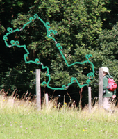
What is the point of the map layer "none"
Maybe it seems quite useless to have a map layer option "none". But quite a few of our users referred to it, for sometimes quite creative solutions. A few are listed here.
Combine a route as a layer with photos or other backgrounds
If you take a screenshot with a route and the map layer "none" you can easily combine it with a photo by placing the plain background transparent as in this example.
Navigating with just the route
A lot of users like to use route-only navigation to focus on the route when navigating.
To clearly see the overlay map layers
RouteYou has numerous additional overlay maps such as nodes, mountain bike networks, GR networks, road features. If a "busy" base map is used you don't see those overlay maps as clearly. Selecting "none" as the base map solves that.