Node strip
Table of contents
- Videotutorial
- What is a node strip
- The Formats
- Virtual versus physical nodes
- Where do I find the node strip?
- For whom?
- Frequently asked questions
Videotutorial
Downloading a node strip for print
What is a node strip
If you would like to take your route via nodes with you on paper, you can use our print option 'the node strip'.
We provide the following information:
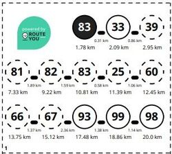
- The node numbers in the correct order and in a clear black outlined circle. The nodes at the beginning and end of the route are shown in a full black circlewith the respective node number in white.
- The total distance from the start of the route is given next to each node.
- We also state the number of kilometers between two successive nodes.
For an overview of all print options, click here.
The Formats
In the download we offer you the node list in two different formats.
1/ The vertical node strip
In this format you get a vertical sequence of the node list. If it is a long route, the node list is sorted into several columns. Just cut and stick together!
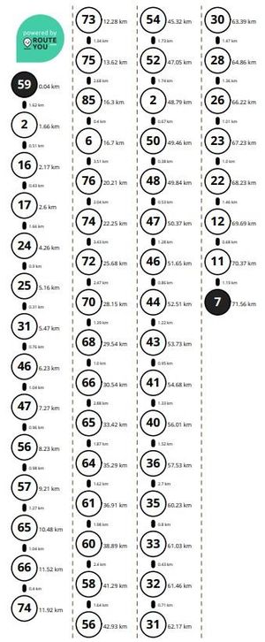
Tip: This is the ideal format in combination with the use of a 'Fietsmaatje'.
2/ The horizontal node strip
With this format you get a horizontal sequence of the node list. The node list is sorted into different rows and blocks so that it is easy to read and cut out. The larger blocks are numbered so that the correct order is not lost.
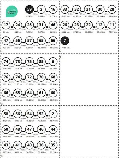
Tip: his is the ideal format in combination with a Knooppunter holder or for on top of your handlebar bag.
Virtual versus physical nodes
The popular navigation through the node system means that these types of networks are still expanding daily: in other regions and countries.
Most networks are also physically signposted in the field with signs. However, in some cases the node-to-node network is only offered digitally and there will be no signposts in the field. In that case we speak of a virtual node network.
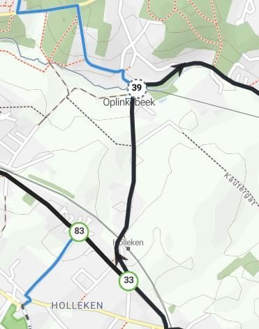
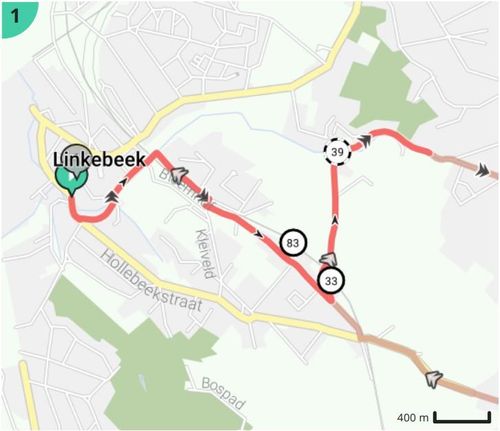
On RouteYou we offer both and it is also possible to create a route that combines physical and virtual nodes. To make the distinction clear, physical nodes are shown in a circle edged with a solid line and virtual nodes in a circle edged with a dashed line. This representation is applied both online and in print.
ONLINE:
PRINT EXAMPLES:

Where do I find the node strip?
- Go to the desired node based route.
- Click on the icon 'Downloaden - Print'
 in the top right-hand column.
 - Under Print, select the Node strip.
- Adjust your printing preferences if necessary and click on 'Download'.
Warning!
Although a node strip is a beautiful and compact way to navigate your route, it is susceptible to problems such as disappearing signs.
That's why we advise you to always bring a map printout like the overview map or the Roadbook in addition to a node strip (read more here).
For whom?
The node strip is accessible to every RouteYou user. However, the additional printing options are also determined by your account level:
- From a free account, you can adjust the following items:
- the paper size: A4 or smaller
- the orientation of your map image: portrait or landscape
- the output format: a pdf or an image (png-format).
- From a Premium account or higher, you can choose to print a route on a larger paper size than a standard A4.
Frequently asked questions
Why doesn't every node route seem to offer the node strip as a print option?
The node strip is only offered as a print option for routes that have actually been plotted with a node routing. Only in that case will a clear link be made to the map layer containing the junction network.
You can also create a route in the route planner using, for example, the 'nicest' or 'shortest' routing and visualize the node network as a map layer. In this way, you can also map out a route partially or completely along the node network. However, technically no link is made with the node layer. That is only the case for a node routing. So in that case, a node list or strip will NOT be generated automatically.